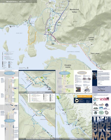
2016 Edition
Updates include:
- The new Brotherhood Bridge underpass and multi-use path to the UAS campus
- Newly paved 4ft shoulders along Fritz Cove Road
- New locations of Mendenhall Valley Public Library and the SLAM
Digital Version
Download the map pdf, 2.3 MB
Paper Version
The following locations offer free paper copies of the Juneau Bike Map:
- Alaska Marine Highway Ferry Terminal
- Cycle Alaska
- Juneau Convention and Visitors Bureau
- Juneau International Airport
What is the Juneau Bike Map?
The Juneau Bike Map is a free community resource to help residents and visitors alike navigate the city by bicycle. Streets are color-coded to show multi-use paths, bike lanes and shoulders, and recommended routes where cyclists must share the road with vehicles. The map also identifies:
- Mountain bike trails
- Hiking trails
- Information centers
- Schools, parks, public restrooms, and camping
- Transit centers
- The ferry terminal
- The Juneau International Airport
- Riding and safety tips
Acknowledgements
The Juneau Bike Map was made possible through the generous support of many individuals, organizations, and businesses. Thank you for supporting cycling in Alaska’s capital city.
Special thanks to:


Thanks also to:


Credits
The Juneau Rides bike map team consisted of Sarah Bronstein, Jack Kreinheder, John McConnochie, Corey McKrill, Justin Shoman, and Alice Tiernan. The map was designed by Corvus Design Landscape Architects and printed by the Printing Trade Company in Juneau, Alaska.


